Where is it?
Go Back to features index

ILLEGALS and LOCALS
With the break-up of the Soviet Union in 1991, stamps started to appear from many of the former states. Being new 'countries' we are frequently being asked where they are. The following is a brief listing of some of these states along with some 'Locals' - the locations of which have also puzzled many collectors.
With the break-up of the Soviet Union in 1991, stamps started to appear from many of the former states. Being new 'countries' we are frequently being asked where they are. The following is a brief listing of some of these states along with some 'Locals' - the locations of which have also puzzled many collectors.
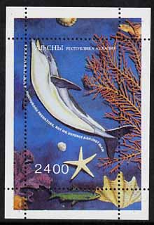
ABKHAZIA also spelled ABKHAZIYA, republic in northwestern Georgia, between the Black Sea (south) and the crest line of the Greater Caucasus range (north). Bordering the eastern shores of the Black Sea, the republic consists of a narrow coastal lowland broken by mountain spurs, followed by a hilly foreland zone of eroded marine and river terraces that merge into the steep slopes of the Caucasus Mountains.
>

BARDSEY An island of some 450 acres lying two miles off the Lleyn Peninsula on the coast of Gwynedd and with the only bird observatory in Wales. The Welsh name is Ynys Enlli, which means 'the island in the tide-race'. Since 1975 it has been owned by the Bardsey Island Trust, a registered charity, which is developing it into a nature reserve. The British Post Office employ a fisherman to deliver and collect mail from the resident population one day a week from and to Aberdaron on the mainland, and allow the Trust to operate a service for visitors on the other days. This service is subject to boat availability and weather conditions, the crossing being difficult even during spring and summer.
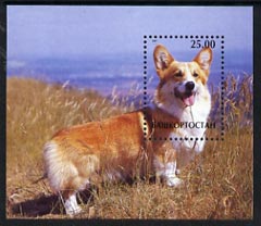
BASHKORTOSTAN also called BASHKIRIYA, republic in Russia, extending from the western slopes of the southern Ural Mountains in the east to the rolling hills of the Bugulma-Belebey Upland in the west. Cold Siberian air masses severely affect the humid, continental climate of the republic. Extreme temperatures of -49deg F (-45deg C) in the winter and 97deg F (36deg C) in the summer may be recorded. The southern part of the republic suffers from the scorching and drought-producing sukhovey winds in late spring and summer. Rainfall varies from 16 to 20 inches (400 to 500 mm) in the steppe areas to 24 inches (600 mm) in the mountains. Settled during the khanate of the Golden Horde by the Turkic Bashkirs, the area passed to Russia in 1552 after the overthrow of the Kazan khanate by Tsar Ivan IV the Terrible. In 1574 the Russians founded Ufa (q.v.), now the capital and largest city of the republic. By the middle of the 18th century, copper and iron production had begun in the area, and it was an autonomous republic of the U.S.S.R. from 1919 to 1991. (see also Index: Ufa) Included in the Volga economic region of Russia. The republic's rich mineral resources provide many raw materials for its expanding industries. Oil and natural gas are extracted from oil fields near Ufa and Neftekamsk in the northwest, at Belebey in the west, and at Ishimbay on the middle Belaya; iron ore and manganese are mined in the Urals, copper in the southeast, and salt near Sterlitamak; and quarries provide materials for the glass and cement industries. Petroleum production, refining, and processing rank as the most important of the republic's industries. Agriculture is most important in the Belaya River valley. The main agricultural products include rye, oats, corn (maize), flax, sugar beets, potatoes, and sunflowers; market gardening flourishes around Ufa and Sterlitamak, while stock raising (cattle, sheep, goats) predominates in the Urals. The area is noted for its breed of horses, and beekeeping, a traditional occupation, is widespread. Area 55,400 square miles (143,600 square km). Pop. (1991 est.) 3,983,900.
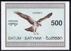
BATUM part of the Ottoman Empire signed over in the Armistice at Mudros, marking its defeat in World War I (1914-18). Under the terms of the armistice, the Ottomans surrendered their remaining garrisons in Hejaz, Yemen, Syria, Mesopotamia, Tripolitania, and Cyrenaica; the Allies were to occupy the Straits of the Dardanelles and the Bosporus, Batum (now in southwest Georgia), and the Taurus tunnel system; and the Allies won the right to occupy "in case of disorder" the six Armenian provinces in Anatolia and to seize "any strategic points" in case of a threat to Allied security. The Ottoman army was demobilized, and Turkish ports, railways, and other strategic points were made available for use by the Allies.

BERNERA the Bernera Islands consist of Great Bernera (which covers 10 square miles and lies north-west of the Isle of Lewis in the Outer Hebrides) and Little Bernera (which covers less than one square miles and lies just off Great Bernera). A bridge connects Great Bernera to Lewis but Little Bernera is reached by boat. The Laird of the Islands maintains a local postal service with three posting boxes on Great Bernera and one on Little Bernera which are serviced at regular intervals for the benefit of tourists. The boatman who ferries visitors to the uninhabited Little Bernera, carries a supply of Bernera stamps. He also collects the mail and reposts it in the official post office on Great Bernera with a British stamp added. Postal rates are double those of the United Kingdom and proceeds from the sales of stamps go to the Bernera Community Council, from whom they are available.
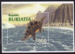
BURIATIA also spelled BURYATIYA, or BURYATIA, republic of Russia in eastern Siberia. Buryatia lies along the eastern side of Lake Baikal, with a panhandle bordering Mongolia and extending westward beyond the southern end of the lake. It was created in 1923 by the union of the Buryat-Mongol and Mongolo-Buryat autonomous oblasts (provinces) and was called the Buryat-Mongol Autonomous Soviet Socialist Republic until 1958 and simply the Buryat A.S.S.R. from then until 1991.
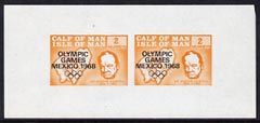
CALF OF MAN lies about a quarter of a mile off the south-west coast of the Isle of Man and is administered by the Manx Museum and National Trust in Douglas as a nature reserve and bird observatory. A mail service was operated by the GPO until 1945. With the growth of mail from visitors and residents at the observatory, the service was restarted in 1962 and operated for eight months of the year. This service is operated by the Manx Museum and National Trust who decided to issue stamps. By order of the Isle of Man Post Office, no Calf stamps would be issued after March 1973. Calf stamps (with the exception of a few Decimal issues) are denominated in murreys, after the Douglas merchant John Murrey who minted the first Manx coinage (murrey pence) in 1968. (24 murreys = 1s = 5p)
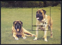
CHUVASHIA also spelled CHUVASHIYA, republic in western Russia that is inhabited mainly by the Chuvash people. Its capital is Cheboksary. Chuvashia occupies the right (southwest) bank of the middle Volga River and is drained by tributaries of that river - the Sura in the west, the Great (Bolshoy) Tsivil and Little (Maly) Tsivil in the centre, and the Kubnya in the east. Most of the area consists of the so-called Chuvash Plateau, low, rolling hills, much cut up by ravines, which forms the extreme northern end of the Volga Upland and drops gradually to the terraces and floodplain of the Volga. In the west, along the Sura River, are alluvial sands of ancient origin. The boundary between the forest and forest-steppe natural zones crosses the republic. The Sura sands are densely forested with pine, while in the north are areas of mixed and deciduous forests. Much of Chuvashia's original forest cover has been removed by overcutting, and about half of the land area is cultivated. In the east and southeast are patches of black-earth soils, almost all of which are tilled. Along the Volga and Sura rivers are floodplain meadows. The climate is moderately continental, with warm summers and long, cold winters. Rainfall is low, 16-20 inches (400-500 mm) a year.
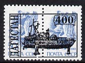
DAGESTAN republic in southern European Russia. Dagestan lies on the eastern end of the northern flank of the Greater Caucasus range, along the western shore of the Caspian Sea. The capital is Makhachkala. Dagestan can be divided into five physical regions. The first, occupying most of the southern half of the republic, consists of the Caucasus Mountains, there at their widest. The southern boundary of Dagestan runs along the main crest ridge, which rises to 11,968 feet (3,648 m) in Mount Guton and 14,652 feet (4,466 m) in Mount Bazar Duzu. North of the main range the Andysky-Salatau and Gimrinsky ranges enclose a huge triangle of extremely rugged mountains known as the Dagestan Interior Highland. These mountains are cut up by the deep valleys and canyons of many rapid rivers flowing down to the Caspian Sea, notably the Sulak, the Samur, and the Kurakh. Rainfall is very scarce in the mountains, and wide areas are devoid of vegetation.
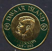
DAVAAR an island at the mouth of Campbeltown Loch in Kintyre Peninsular, Argyll, noted for a cave painting of the crucifixion. The lighthouse on the north-east side has a permanent staff, who are employed by the Northern Lighthouse Board. Supplies, mail and visitors are brought to Davaar by a local boatman. A postal service operated until the early 1970's, then lapsed, but has since been restored. Postal rates are currently double those of the United Kingdom.

DHUFAR also spelled DHOFAR, Arabic ZUFAR, historical region in southern Oman, extending from Cape Ash-Sharbatat on the coast of the Arabian Sea southwestward to the Oman-Yemen border. The region's northern boundary has never been defined, but generally included in the territory is the Wadi Mughshin, located about 150 miles (240 km) inland. To the northeast of Dhofar is a large desert of stony plains and sand dunes that contribute to the region's isolation from northern Oman. The Salalah coastal plain (about 40 miles [64 km] long and ranging from 1 to 6 miles [1.5 to 9.5 km] wide), facing the Arabian Sea, is considered one of the most beautiful in Arabia, particularly in its southwestern part, because of its monsoon climate and temperate vegetation and bird life; the region has constantly flowing streams, making it Oman's most fertile area. About 10 miles (16 km) inland the rugged al- Qara` Mountains rise to heights of between 3,000 and 4,000 feet (900 and 1,200 m). Farther north the al-Qara` Mountains give way to a pebbly desert, beyond which lies the Rub' al-Khali ("Empty Quarter") of Saudi Arabia.
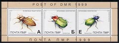
DNISTER MOLDAVIAN REPUBLIC (DMR) A Republic belonging to Russia situated near Moldova, the capital city is Tiraspolj. Stamps have been issued for some years, but the earlier issues were locally printed on poor paper. The different letters in the corners relate to the different tariffs, and these are linked to the US dollar. DMR stamps are expected to be listed in Michel-Rundschau catalogue.
EASDALE A small island in Argyll on the west coast of Scotland, 16 miles south of Oban. During the 18th and 19th centuries, the island had a thriving slate industry but this suffered when building requirements favoured clay tiles. Finally, the first world war took most of the men away and the industry collapsed. Today the island supports a permanent population of about 90.
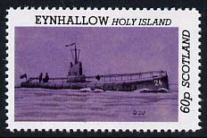
EYNHALLOW also known as Holy Island lies between the Orkney Islands of Mainland (Pomona) and Rousay. It is uninhabited and maintained as a nature reserve

GAIRSAY lies at the eastern end of Eynhallow Sound and at the northern exit of Wide Firth, Orkney. The island is privately owned and has a postal service to Finstown guaranteed by the owner. The postal rates are currently double those of the United Kingdom.
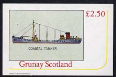
GRUNAY One of the Out Skerries of Shetland with a postal service guaranteed by the owner, to the nearest sub post office on the island of Housay. The postal rates are currently double those of the United Kingdom.
HERM An island off Guernsey, Channel Islands, one mile by half a mile. From 1925 to 1938 the island was served by a sub post office of the Guernsey Head Office, but this was closed due to a lack of business. Herm was leased to tenants from 1946 and in 1949 local stamps were issued to prepay the cost of carriage by boat to Guernsey, where letters and packets, additionally franked with British stamps, were taken to the Head Post Office for onward transmission. All postal arrangements were subject to the approval by the States of Guernsey, from whom the tenants leased the island. When Guernsey became postally independent in October 1969, the Herm Locals were banned and a sub post office was opened on the island.

INGUSHETIA republic in southwestern Russia. The crest line of the Greater Caucasus range forms its southern boundary with Georgia; the Russian republic of Chechenia lies to the east, and that of Alania (formerly North Ossetia) to the west and north. The capital city is Nazran.
KALMYKIA republic in southwestern Russia, lying northwest of the Caspian Sea and west of the lower Volga River. On the east it reaches the Caspian shore, and in the northeast it touches the Volga. Most of the republic lies in the vast lowland of the northern Caspian Depression, the greater part lying below sea level. The Yergeni hills and the Salsk-Manych ridge rise to a maximum of 725 feet (221 m) along the republic's western boundary. A long panhandle of the republic extends westward through the Manych Depression, containing large salt lakes by way of which the Caspian was formerly linked to the Black Sea. East of the Yergeni, the republic stretches to the Caspian as a level plain, broken only by small hollows and by ancient burial mounds. The Yergeni has steppe-grass vegetation and groves of deciduous trees (willow, elm, and poplar) in the valleys; elsewhere the republic is semidesert. The climate is characterized by hot summers and low rainfall, which often comes in torrential downpours causing flash floods in the valleys.
KAZAKSTAN also spelled KAZAKHSTAN, officially REPUBLIC OF KAZAKSTAN, Kazak QAZAQSTAN RESPUBLIKASÃ, the largest country of Central Asia. Kazakstan obtained its independence from the Soviet Union in 1991. It is bounded by Russia on the northwest and north; China on the east; Kyrgyzstan, Uzbekistan, the Aral Sea, and Turkmenistan on the south; and the Caspian Sea on the west. The capital is Almaty (formerly Alma-Ata), with Aqmola (formerly Tselinograd) designated to become the new capital by 2000. Area 1,052,100 square miles (2,724,900 square km). Pop. (1996 est.) 16,677,000.

KOMI a republic in northwestern Russia. Syktyvkar is the capital. The republic extends from the crest line of the Northern Urals on the east to the Timan Ridge and the upper basins of the Mezen and Vychegda rivers on the west. The republic lies mainly in the flat, featureless basin of the Pechora River. Industrial development in the republic centres upon its abundant forests and its deposits of coal from the Vorkuta and Inta areas of the Pechora River basin, oil from the Usinsk, Vozey, and Ukhta areas, and natural gas from Vuktyl. Wood products include veneers, prefabricated houses, and barges and rivercraft. After the construction of the Pechora railway from Kotlas to Vorkuta in the early 1940s, mining became the major branch of the economy. Other industries include chemical production, power engineering, machine building, metalworking, light manufacturing, and food processing. Because of Komi's northerly location and poor soils, agriculture is little developed. Only a small area along the rivers in the south is cultivated in rye, potatoes, oats, barley, and vegetables. Stock raising (mostly cattle and reindeer) is more important. Fur trapping (squirrel and Arctic fox) is common in the forests. Apart from the many navigable rivers, which are closed by ice 180 to 220 days a year, the major line of communication is the Pechora railway, with a branch to Syktyvkar and a number of narrow-gauge feeders for timber exploitation. Syktyvkar has air connections with Moscow, St. Petersburg, and other Russian cities. Area 160,600 square miles (415,900 square km). Pop. (1993 est.) 1,245,700.
KORIAKI REPUBLIC This region includes the eastern slopes of the Kolymskiy Range (highest elevation 1800 m), the plains of the upper Anadyr River (Bering Sea Basin), the Penzhina River (Sea of Okhotsk Basin), and the Koryakskiy upland (reaching 2562 m), which lies between the Bering Sea coast and the Kamchatka Peninsula. The eastern region borders the Bering Sea and the southwestern part borders the Sea of Okhotsk and Penzhina Bay. The climate of the region is subarctic, influenced by the Pacific monsoon. Within the region the climate changes from submaritime in the west to maritime on the coast of the Bering Sea. Mean annual temperature ranges from -4.1 to -4.6 C, with freezing temperatures starting by the end of September. Mean January temperature does not fall below -13 to -16 C in the coastal areas. The warmest month is August, with mean temperature reaching 8.0-8.6 C. Due to the cold water with lingering sea ice, this region receives less precipitation than Kamchatka to the south. Annual precipitation ranges from 300 mm in the interior to 700 mm on the coast, but may reach 900 mm at higher elevations. Most precipitation falls in summer.
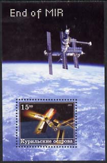
KURIL ISLANDS Russian KURILSKIYE OSTROVA, Japanese CHISHIMA-RETTO, archipelago in Sakhalin oblast (province), far-eastern Russia. The archipelago extends for 750 miles (1,200 km) from the southern tip of the Kamchatka Peninsula (Russia) to the northeastern corner of Hokkaido island (Japan) and separates the Sea of Okhotsk from the Pacific Ocean. The 56 islands cover 6,000 square miles (15,600 square km).
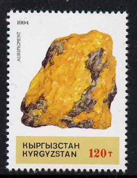
KYRGYZSTAN officially KYRGYZ REPUBLIC, Kyrgyz KYRGYZ RESPUBLIKASY, formerly (1936-91) KIRGIZIYA, or KIRGHIZIA, or KIRGIZ SOVIET SOCIALIST REPUBLIC, historical region and country of Central Asia. Kyrgyzstan is bounded by Kazakstan on the north and northwest, Uzbekistan on the southwest, and Tajikistan on the south. On the southeast, the Kok Shaal-Tau Range, part of the Tien Shan (mountains), forms the border with China. The capital is Bishkek (formerly Frunze). Area 76,600 square miles (198,500 square km). Pop. (1996 est.) 4,521,000.
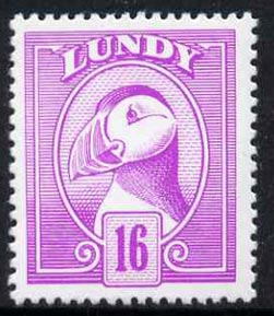
LUNDY An island in the Bristol Channel, 12 miles north-west of Hartland Point, Devon. It is about three miles long, over half a mile wide and rises over 460ft above sea level. The GPO operated a sub post office from 1886 to 1927 but it was closed after a disagreement with the owner of the island, Martin Coles Harman. Mr Harman then organised his own boat service to carry mail to Bideford (and subsequently Ilfracombe), issuing the first stamps in November 1929. An airmail service operated to and from Barnstaple from 1934 to 1956 and in 1981 some mail was carried by helicopter to Harland Point. The island was bought from the Harman family in 1969 by the National Trust, who lease it to the Landmark Trust. The unit of currency is the puffin, named after the seabird, 1 puffin = 1p (formerly 1 puffin = 1d).
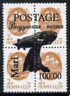
MARIJ EL An area within the Volga-Kama region approximately 800 Km east of Miscow. Manufactures include pharmaceuticals and agricultural machinery. Yoshkar-Ola is the capital city, which was founded in 1578 as a Russian outpost.
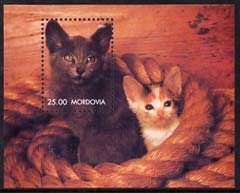
MORDOVIA The Republic of Mordovia is located in the centre of European part of Russia in the Volga basin at the crosspoint of the most important routes from the Centre to the Ural region, Siberia, the Volga region, Kazakhstan and Middle Asia. Total occupied area is 26.2 thousand sq. km. The Republic stretches from west to east for about 280 km (between longitudes 42° 12'E and 46° 43'E) and from north to south for 55 to 140 km (between latitudes 53° 40'N and 55° 15'N). It borders the Nizhny Novgorod region in the north, the Ulyanovsk region in the east, the Penza region in the south, the Ryazan region in the west and Chuvashya Republic in the northwest. The Republic is divided into 22 administrative districts. There are 7 towns within its territory, among them Saransk, Ruzaevka, Kovylkino are under republican subordination and Ardatov, Insar, Krasnoslobodsk, Temnikov are under district subordination. The capital of the Republic is Saransk with population of 336 000 people (2003) which is situated 600 km away from Moscow. The population of Mordovia has been estimated at 899.6 thousand people as on 1st January 2003, comprising 540.6 thousand urban residents and 359.0 thousand rural residents. The dominating religion of the Republic population is Orthodox Christianity.
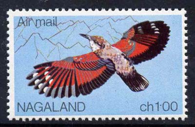
NAGALAND constituent state of India, in the northeastern corner of the country. It is bounded on the east by Myanmar (Burma), on the south by the Indian state of Manipur, and on the west and northwest by the Indian state of Assam. A small section of Nagaland extends north from the Myanmar border into the Indian state of Arunachal Pradesh. The capital is Kohima.
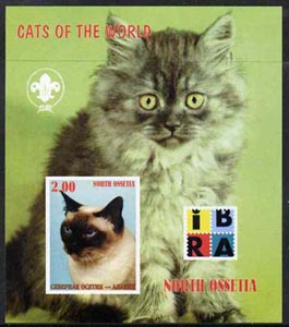
NORTH OSSETIA also called NORTHERN OSSETIA, or OSSETIA, Russian SEVERNAYA OSETIYA, Ossetia also spelled OSSETIYA, or OSETIYA, republic in southwestern Russia, on the northern flank of the Greater Caucasus range. It is bordered on the south by Georgia and on the north by the Sunzha and Terek ranges
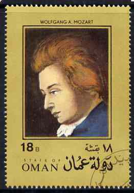
OMAN officially SULTANATE OF OMAN, Arabic SALTANAT 'UMAN, country occupying the southeastern coast of the Arabian Peninsula. Oman spans about 585 miles (940 km) from southwest to northeast and about 215 miles (350 km) from northwest to southeast. It also includes an enclave, Ru`us al-Jibal ("The Mountaintops"), occupying the northern tip of the Musandam Peninsula between the Gulf of Oman and the Persian Gulf. Oman proper is bordered on the southwest by Yemen, on the west by Saudi Arabia, on the northwest by the United Arab Emirates, on the north by the Gulf of Oman, and on the south and east by the Arabian Sea. The capital is Muscat (Masqat). Area 118,150 square miles (306,000 square km). Pop. (1992 est.) 1,640,000.
PABAY or Priest Island lies two miles from broadford on the Isle of Skye and covers an area of about one square mile. When the island was bought by A L Whatley in 1950, there was no mail collection, although the GPO agreed to a weekly delivery to be carried out by an allowance deliverer, who was offered three hours pay plus an allowance for his boat. The GPO refused to provide a second weekly delivery which Mr Whatley required for his handicrafts business. Whatley then started his own local service which lasted until 1970. he bought boats specially for the purpose and from 1962, issued his own stamps. In 1972 a new owner took over and ran the island as a nature reserve, continuing to issue stamps. The rates for letters and postcards was 3p in 1972, 7p in 1978 and 10p in 1981.
SAHARA REPUBLIC is a part of Morocco proclaimed by the Polisario Separatists. The Republic was a Spanish Protectorate when Morocco was still under French rule. They claimed independence after Spain gave them autonomy. They were admiited as a full member of the Organisation of African Unity in 1987, prompting Morocco to leave the said organization.
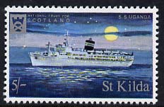
St KILDA a group of islands in the Outer Hebrides, lying 110 miles west of the Scottish mainland and maintained by the National Trust for Scotland as a wildlife sanctuary. They are the remotest inhabited British islands. A GPO sub post office operated from 1900 to 1930, when the small and ageing population was evacuated. The islands remained uninhabited until an Army tracking station was established on the main island, Hirta, in the 1950's. The RAF delivered mail from April 1957 to August 1958 and the function has since been performed by the Army. Stamps were prepared by the National Trust as tourist souvenirs and were on sale at their shops on the mainland as well as on Hirta until 1971.
SAKHALIN ISLE also spelled SACHALIN, Russian OSTROV SAKHALIN, Japanese KARAFUTO, island at the far eastern end of Russia. It is located between the Tatar Strait and the Sea of Okhotsk, north of the Japanese island of Hokkaido. With the Kuril Islands, it forms Sakhalin oblast (province).
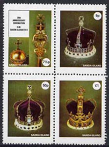
SANDA lies some three miles south of Southend at the tip of the Mull of Kintyre, Argylshire. It has a lighthouse with a resident staff employed by the Northern Lighthouse Board, who pay a boatman to deliver mail and provisions. Local stamps are known to be used on outgoing mail from 1962 to 1970, although stamps continued to be produced until 1978, many of the designs being similar to those for Davaar.
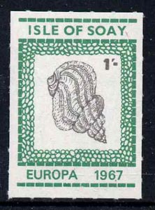
SOAY the Isle of Sheep covers some three square miles and lies off the south-west coast of skye at the entrance to Loch Scavaig. The island had its own post office until July 1953 when the population was evacuated to Mull. The return of families led to a fortnightly GPO delivery and collection of mail to and from Mallaig on the mainland. Stamps were produced from 1965 to 1967 without the owner's permission and are therefore bogus.
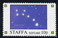
STAFFA lies seven miles off the west coast of the Inner Hebrides Island of Mull and six miles north-east of Iona. It is the site of Fingal's Cave, one of the most remarkable natural phenomena in Britain and the inspiration of many artists, notably Mendelssohn who composed his Hebrides Overture after a visit to Staffa in 1829. The Laird of Staffa has established a postal service, which operates daily from April to September (weather permitting) for the 20,000 visitors each year to the uninhabited island. Mail is deposited in a posting box on the island, taken out by a boatman and then transported to the official post offices on Mull and (recently also) Iona for onward transmission. The rates are double those of the United Kingdom and the stamps are available on the boat which carries visitors to Staffa, on the island itself, in a permanently established structure which serves as a 'post office', and on Iona.

STEEP HOLM an island in the Bristol Channel midway between the English and Welsh coasts and reached by boat from Weston-Super-Mare. It was bought in 1976 by the Kenneth Allsop Memorial trust, a registered charity, as a memorial to the naturalist and broadcaster who died in 1973. There is no permanent population but researchers in scientific and environmental fields stay for extended periods and a weekly crossing is made by members of the Trust. There is no Post Office and mail bearing Steep Holm stamps is posted in a George VI wall-mounted letter box, given in trust by the British Post Office and mounted on the wall of the Victorian barracks, which serve as the island's visitor centre. A local cancellation is applied and the mail is taken to Weston-Super-Mare or Burnham-On-Sea for onward transmission. Proceeds from the stamps assist the Trust in its work.
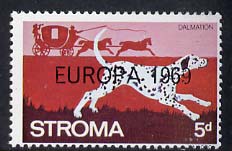
STROMA the island in the current lies in Pentland Firth between John O'Groats on the north-eastern tip of Scotland and the Orkney Islands. While the island supported a resident population a GPO sub post office operated, but it closed in October 1958 when the last of the families left. An American television quiz programme offered the island as a prize in 1960 and the following year it was sold to an anonymous buyer. The stamps which first appeared in 1962 for the summer visitors, were intended to defray the costs of running a mail boat to Huna, near Wick, on the mainland. The last issues appeared in 1971 and many of the design are similar to those for Pabay.
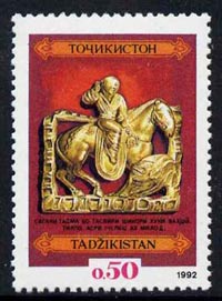
TAJIKISTAN, Tajikistan also spelled TADZHIKISTAN, Tajik TOJIKISTON, or JUMHURII TOJIKISTON, country of Central Asia that gained independence from the Soviet Union in 1991. Tajikistan is bounded by China to the east, Afghanistan to the south, Kyrgyzstan to the north, and Uzbekistan to the north and west. The autonomous region of Gorno-Badakhshan is located in the eastern half of the country. The capital is Dushanbe. Area 55,300 square miles (143,100 square km). Pop. (1995 est.) 5,832,000.
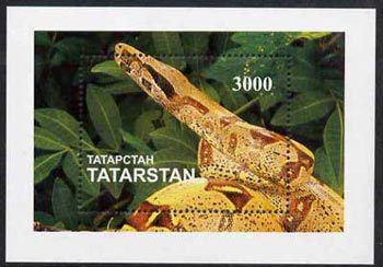
TATARSTAN also called TATARIYA, republic in the east-central part of European Russia. The republic lies in the middle Volga River basin around the confluence of the Volga and Kama rivers. Kazan is the capital. The Volga flows north-south across the western end of the republic, while the Kama, the Volga's largest tributary, forms a roughly east-west axis through the greater part. The Vyatka and the Belaya rivers are major tributaries of the Kama. Generally the relief is that of a low, rolling plain. The area west of the Volga rises to 771 feet (235 m), representing the extreme northern end of the Volga Upland. In the east the land rises to the Urals foreland. The climate is continental, with long, severe winters and hot summers. Annual rainfall is about 17-20 inches (420-510 mm), with a summer maximum.
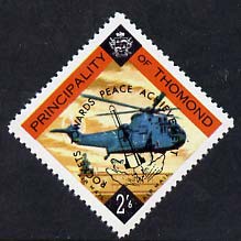
THOMOND Part of Ireland which includes the present county of Limerick and part of Tipperary. The Danish Vikings often raided this county during the ninth and tenth centuries, but were finally defeated in 1014 by the O'Briens. In 1656 Thomond was made into a shireland and called Clare. Following the defeat in 1641 of the rebellion of Catholic Confederacy, Clare was set aside to accommodate 'delinquent proprietors' ie those whose land was confiscated because they did not actively oppose the rebellion. The county was badly affected by the great famine of 1845-47 and the population declined, many emigrating, mainly to Australia. Descendants of the early families (the Dalcassians) still claim ownership of the land, part of which is occupied by Shannon Airport.
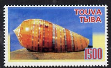
TOUVA or TUVA also called TYVA, or TANNU-TUVA, republic in south-central Siberia, Russia. Tuva borders northwestern Mongolia and occupies the basin of the upper Yenisey River. Its relief consists of two broad basins, the Tuva and Todzha, drained by two main tributaries of the Yenisey River. High mountain ranges, including the Eastern Sayan and Western Sayan mountains to the north, enclose the basins. A continuous series of ranges also enclose the republic on the west, south, and southeast: the Altai, Tannu-Ola, and Sangilen mountains. The highest point is Mount Munku-Taiga (Mongun-Taiga; 13,044 feet [3,976 m]) in the extreme southwest. The climate is generally of the dry, sharply continental type, with severe winters and warm summers. Vegetation ranges from dry steppe in the basins to dense coniferous forests to alpine meadows that are succeeded by bare rock and snow at the highest elevations.
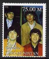
TURKMENISTAN country of Central Asia that gained independence from the Soviet Union in 1991. Turkmenistan is bounded by Kazakstan on the northwest, Uzbekistan on the north, northeast, and east, Afghanistan on the south and southeast, and Iran on the south and southwest. The Caspian Sea forms the western border. The capital is Ashgabat (Ashkhabad). Area 188,500 square miles (488,100 square km). Pop. (1994 est.) 4,044,000.
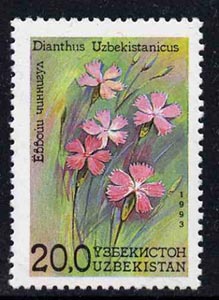
UZBEKISTAN, Uzbek UZBEKISTON, or UZBEKISTON RESPUBLIKASI, country in Central Asia that gained independence from the Soviet Union in 1991. It is bounded by Kazakstan on the north and west; by Kyrgyzstan and Tajikistan on the east and southeast; by Turkmenistan on the southwest; and for a short distance in the south by Afghanistan. The capital is Tashkent (Toshkent). Area 172,700 square miles (447,400 square km). Pop. (1996 est.) 23,206,000.
>
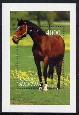
YAKUTIA or Sakha Republic in far northeastern Russia, on the Lena River. A fort was founded on the Lena's low right bank in 1632 and transferred 43 miles (70 km) upstream to the present site of Yakutsk in 1642 and now serves as the capital. Long a small provincial centre of wooden houses where, beginning in the 19th century, dissidents were exiled, Yakutsk has grown in sizeand acquired light industries, up-to-date housing, and paved streets, but its functions remain primarily those of administration and of a river port. It has a university (founded 1956). Pop. (1994 est.) 194,400.

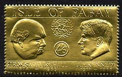
Stamps from some of the above territories have been produced by agencies without Government or Official authorisation, and as such are deemed to be 'illegal'. Such issues along with 'Locals', 'Local carriage labels' and other 'cinderella' items do not appear in standard Catalogues and should not be used in competitions. We list them as many collectors are happy to include them in their thematic collections together with match box labels, cigarette and trade cards, postcards and the like. If in doubt please contact us - we will be happy to advise.
- Stamps on Advertising
- Stamps on Afghan
- Stamps on Agriculture
- Stamps on Aids
- Stamps on Airports
- Stamps on Airships
- Stamps on Alcohol
- Stamps on American Football
- Stamps on Americana
- Stamps on Ancient Greece
- Stamps on Andrew
- Stamps on Angels
- Stamps on Animals
- Stamps on Anne
- Stamps on Anne & Mark
- Stamps on Antiques
- Stamps on Apes
- Stamps on Apollo
- Stamps on Archaeology
- Stamps on Archery
- Stamps on Architecture
- Stamps on Arms
- Stamps on Artefacts
- Stamps on Arts
- Stamps on Astrology
- Stamps on Astronomy
- Stamps on Athletics
- Stamps on Audubon
- Stamps on Aviation
- Stamps on Bach
- Stamps on Badger
- Stamps on Badges
- Stamps on Badminton
- Stamps on Ballet
- Stamps on Balloons
- Stamps on Baseball
- Stamps on Basketball
- Stamps on Bats
- Stamps on Battles
- Stamps on Beatles
- Stamps on Beer
- Stamps on Bees
- Stamps on Beethoven
- Stamps on Bells
- Stamps on Bicycles
- Stamps on Birds
- Stamps on Birds of Paradise
- Stamps on Birds of Prey
- Stamps on Blind
- Stamps on Bobsled
- Stamps on Bowls
- Stamps on Boxing
- Stamps on Bridge (card game)
- Stamps on Bridges
- Stamps on Buildings
- Stamps on Buses
- Stamps on Business
- Stamps on Butterflies
- Stamps on Cacti
- Stamps on Cameras
- Stamps on Canals
- Stamps on Canoeing
- Stamps on Canoes
- Stamps on Cars
- Stamps on Cartoons
- Stamps on Castles
- Stamps on Cathedrals
- Stamps on Cats
- Stamps on Cattle
- Stamps on Caves
- Stamps on Census
- Stamps on Ceramics
- Stamps on Cezanne
- Stamps on Charles
- Stamps on Chess
- Stamps on Children
- Stamps on Christmas
- Stamps on Churches
- Stamps on Churchill
- Stamps on Cinderella
- Stamps on Cinema
- Stamps on Circus
- Stamps on Civil Engineering
- Stamps on Clocks
- Stamps on Coin Cover
- Stamps on Coins
- Stamps on Columbus
- Stamps on Communications
- Stamps on Composers
- Stamps on Computers
- Stamps on Concorde
- Stamps on Constitutions
- Stamps on Cook
- Stamps on Coral
- Stamps on Coronation
- Stamps on Costumes
- Stamps on Crafts
- Stamps on Cricket
- Stamps on Cultures
- Stamps on Dams
- Stamps on Dancing
- Stamps on Darwin
- Stamps on De Gaulle
- Stamps on Deaf
- Stamps on Death
- Stamps on Degas
- Stamps on Dental
- Stamps on Diamond
- Stamps on Diana
- Stamps on Dinosaurs
- Stamps on Disabled
- Stamps on Disasters
- Stamps on Discus
- Stamps on Diseases
- Stamps on Disney
- Stamps on Diving
- Stamps on Dogs
- Stamps on Dolphins
- Stamps on Drake
- Stamps on Drink
- Stamps on Drugs
- Stamps on Ducks
- Stamps on Durer
- Stamps on Eagles
- Stamps on Easter
- Stamps on Education
- Stamps on Egyptology
- Stamps on Elephants
- Stamps on Elvis
- Stamps on Energy
- Stamps on Engineering
- Stamps on Engineers
- Stamps on Engravings
- Stamps on Entertainments
- Stamps on Environment
- Stamps on Erotica
- Stamps on Europa
- Stamps on Exhibitions
- Stamps on Explorers
- Stamps on F1
- Stamps on Fairy Tales
- Stamps on Falcons
- Stamps on Farming
- Stamps on Fashion
- Stamps on Fencing
- Stamps on Fergie
- Stamps on Ferrari
- Stamps on Field Hockey
- Stamps on Field-hockey
- Stamps on Films
- Stamps on Finance
- Stamps on Fire
- Stamps on Firearms
- Stamps on Fireworks
- Stamps on Fish
- Stamps on Flags
- Stamps on Flat-tops
- Stamps on Flowers
- Stamps on Folklore
- Stamps on Food
- Stamps on Football
- Stamps on Forgery
- Stamps on Forts
- Stamps on Fountains
- Stamps on Fox
- Stamps on Frogs
- Stamps on Fruit
- Stamps on Fungi
- Stamps on Gamefish
- Stamps on Games
- Stamps on Gandhi
- Stamps on Gauguin
- Stamps on Geology
- Stamps on Giraffe
- Stamps on Globes
- Stamps on Golf
- Stamps on Grain
- Stamps on Gsd
- Stamps on Guides
- Stamps on Guitar
- Stamps on Gymnastics
- Stamps on Hammer
- Stamps on Harbours
- Stamps on Hearts
- Stamps on Hedgehogs
- Stamps on Helicopters
- Stamps on Heraldry
- Stamps on Herbs
- Stamps on High Jump
- Stamps on History
- Stamps on Holograms
- Stamps on Horses
- Stamps on Housing
- Stamps on Human-rights
- Stamps on Hummingbirds
- Stamps on Hunting
- Stamps on Hurdles
- Stamps on Hurling
- Stamps on Ice Hockey
- Stamps on Ice Skating
- Stamps on Indians
- Stamps on Insects
- Stamps on Instruments
- Stamps on Inventions
- Stamps on Inventors
- Stamps on Iron
- Stamps on Irrigation
- Stamps on Islam
- Stamps on IYC
- Stamps on Javelin
- Stamps on Jazz
- Stamps on Jewellry
- Stamps on Judaism
- Stamps on Judo
- Stamps on KE7
- Stamps on Kennedy
- Stamps on KG5
- Stamps on KG6
- Stamps on Kingfisher
- Stamps on Labrador
- Stamps on Lace
- Stamps on Lagoons
- Stamps on Lakes
- Stamps on Lamborghini
- Stamps on Lancia
- Stamps on Land Rover
- Stamps on Languages
- Stamps on Lapwing
- Stamps on Law
- Stamps on Legal
- Stamps on Leisure
- Stamps on Lenin
- Stamps on Leonardo Da Vinci
- Stamps on Leopard
- Stamps on Letter
- Stamps on Libraries
- Stamps on Lighthouses
- Stamps on Lincoln
- Stamps on Lions
- Stamps on Lions Int
- Stamps on Literature
- Stamps on Lizard
- Stamps on Lizards
- Stamps on Llama
- Stamps on Lobster
- Stamps on London
- Stamps on Long Jump
- Stamps on Love
- Stamps on Lunar
- Stamps on Lunar New Year
- Stamps on Lynx
- Stamps on Mafia
- Stamps on Mail Coaches
- Stamps on Malaria
- Stamps on Mango
- Stamps on Mao
- Stamps on Maps
- Stamps on Marilyn Monroe
- Stamps on Marine Life
- Stamps on Martial Arts
- Stamps on Masks
- Stamps on Masonics
- Stamps on Maths
- Stamps on Medals
- Stamps on Medical
- Stamps on Medicinal Plants
- Stamps on Mercedes
- Stamps on MG
- Stamps on Michelangelo
- Stamps on Microphones
- Stamps on Microscopes
- Stamps on Militaria
- Stamps on Millennium
- Stamps on Minerals
- Stamps on Mining
- Stamps on Monuments
- Stamps on Mosaics
- Stamps on Mosques
- Stamps on Motorbikes
- Stamps on Mountains
- Stamps on Mozart
- Stamps on Museums
- Stamps on Music
- Stamps on Musical Instruments
- Stamps on Mythology
- Stamps on Napoleon
- Stamps on Nobel
- Stamps on Nudes
- Stamps on Nurses
- Stamps on Occupations
- Stamps on Official
- Stamps on Oil
- Stamps on Olympics
- Stamps on Opera
- Stamps on Orchids
- Stamps on Owls
- Stamps on Parrots
- Stamps on Peace
- Stamps on Penguins
- Stamps on Personalities
- Stamps on Philosophy
- Stamps on Photography
- Stamps on Picasso
- Stamps on Pigeons
- Stamps on Playing-cards
- Stamps on Poetry
- Stamps on Polar
- Stamps on Pole Vault
- Stamps on Police
- Stamps on Pollution
- Stamps on Polo
- Stamps on Pope
- Stamps on Pops
- Stamps on Ports
- Stamps on Post Office
- Stamps on Postage Due
- Stamps on Postal
- Stamps on Postbox
- Stamps on Postman
- Stamps on Pottery
- Stamps on Power
- Stamps on Prince William
- Stamps on Princess Diana
- Stamps on Queen Mother
- Stamps on Queen-Mother
- Stamps on QV
- Stamps on Rabbits
- Stamps on Racing Cars
- Stamps on Racism
- Stamps on Radio
- Stamps on RAF
- Stamps on Rafts
- Stamps on Railways
- Stamps on Rainbows
- Stamps on Red Cross
- Stamps on Refugees
- Stamps on Relay
- Stamps on Religion
- Stamps on Rembrandt
- Stamps on Renoir
- Stamps on Reptiles
- Stamps on Revolutions
- Stamps on Rifles
- Stamps on Rings
- Stamps on Rivers
- Stamps on Robin
- Stamps on Rolls Royce
- Stamps on Roses
- Stamps on Rotary
- Stamps on Rowing
- Stamps on Royal Visit
- Stamps on Royalty
- Stamps on Rugby
- Stamps on Running
- Stamps on Sailing
- Stamps on Salvation Army
- Stamps on Satellites
- Stamps on Sci-fi
- Stamps on Science
- Stamps on Scotland
- Stamps on Scots
- Stamps on Scouts
- Stamps on Scuba
- Stamps on Sculptures
- Stamps on Self Adhesive
- Stamps on Shakespeare
- Stamps on Shells
- Stamps on Ships
- Stamps on Shooting
- Stamps on Shot
- Stamps on Show Jumping
- Stamps on Show-jumping
- Stamps on Shuttle
- Stamps on Silver Jubilee
- Stamps on Silver Wedding
- Stamps on Sinatra
- Stamps on Skiing
- Stamps on Slavery
- Stamps on Smith
- Stamps on Snakes
- Stamps on Snooker
- Stamps on Social History
- Stamps on Space
- Stamps on Spices
- Stamps on Spitfire
- Stamps on Sport
- Stamps on Squash
- Stamps on Stadiums
- Stamps on Stained Glass
- Stamps on Stamp Centenary
- Stamps on Stamp Exhibitions
- Stamps on Stamp on Stamp
- Stamps on StampOnStamp
- Stamps on Star Wars
- Stamps on Statue of Liberty
- Stamps on Statues
- Stamps on Steel
- Stamps on Steeplechase
- Stamps on Strike
- Stamps on Submarines
- Stamps on Swimming
- Stamps on Table Tennis
- Stamps on Tapestry
- Stamps on Tea
- Stamps on Technology
- Stamps on Teddy Bears
- Stamps on Telephones
- Stamps on Tennis
- Stamps on Textiles
- Stamps on Tin
- Stamps on Titian
- Stamps on Tobacco
- Stamps on Tortoises
- Stamps on Tourism
- Stamps on Towers
- Stamps on Trams
- Stamps on Transport
- Stamps on Trees
- Stamps on Triangulars
- Stamps on Triathlon
- Stamps on Trucks
- Stamps on TUC
- Stamps on Turtles
- Stamps on TV
- Stamps on Umbrellas
- Stamps on Uniforms
- Stamps on United Nations
- Stamps on UPU
- Stamps on Van Gogh
- Stamps on Varieties
- Stamps on Vets
- Stamps on Victoria Cross
- Stamps on Victory
- Stamps on Vikings
- Stamps on Volcanoes
- Stamps on Volleyball
- Stamps on VW
- Stamps on Waterfalls
- Stamps on Weather
- Stamps on Weightlifting
- Stamps on Whales
- Stamps on Wheelchair
- Stamps on Wild West
- Stamps on Wildlife
- Stamps on William
- Stamps on Wind-surfing
- Stamps on Windmills
- Stamps on Women
- Stamps on World Cup
- Stamps on World Cup Football
- Stamps on Wrestling
- Stamps on Writing
- Stamps on WW1
- Stamps on WW2
- Stamps on WWF
- Stamps on X-rays
- Stamps on Yachting
- Stamps on Yachts
- Stamps on Youth
- Stamps on Zebra
- Stamps on Zeppelins
- Stamps on Zodiac
- Stamps on Zoo